Lofoten, Norway
Lofoten Islands Hike - 8-Day Coastal Trail from Å to Svolvær
The classic Lofoten islands hike: 150 km coastal traverse in 8 days. Jagged peaks, white beaches, midnight sun, and planning tips for Norway's most remote long trail.
Published May 7, 2026 · Last updated May 7, 2026 · researched
Map data: © OpenStreetMap contributors, tiles by OpenTopoMap (CC-BY-SA). Approximate location — verify the exact route on the official trail page before hiking.
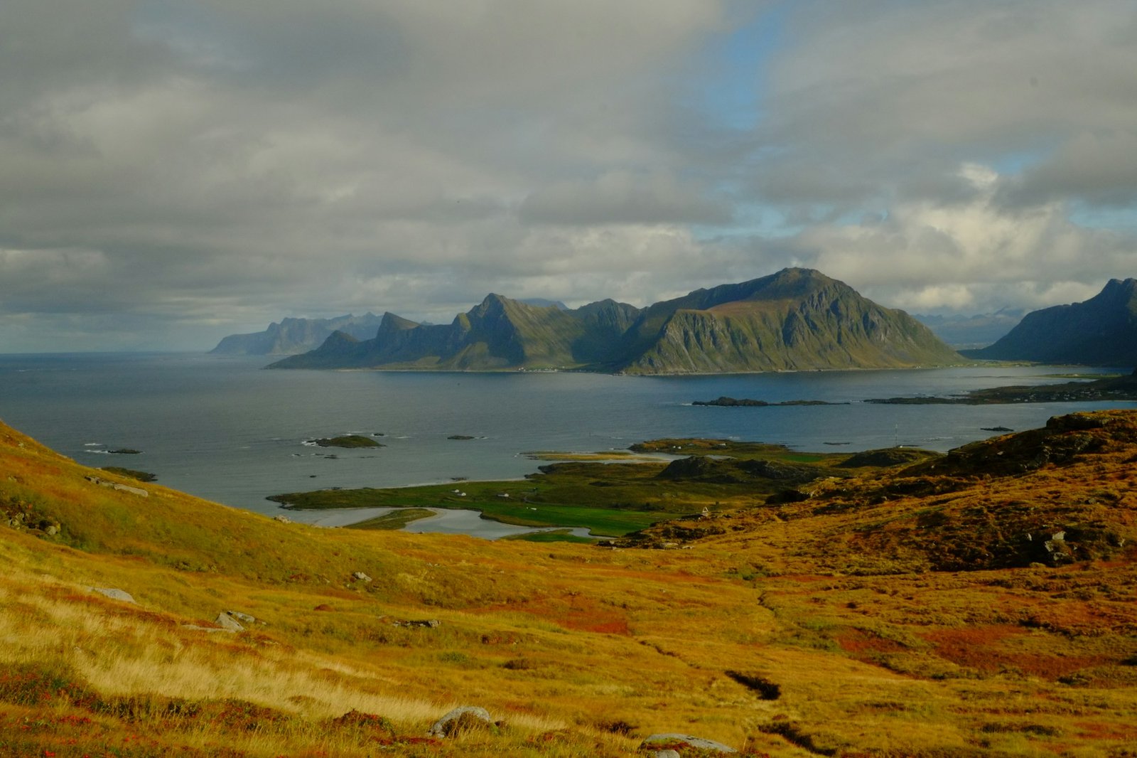
The Lofoten Trail (Lofotstien) is a 150 km route along the spine of the Lofoten archipelago, from Å in the southwest to Svolvær in the northeast. Eight stages, 8000 metres of cumulative elevation gain across granite peaks rising straight from sea level, midnight sun above the Arctic Circle, and white-sand beaches you’d swear were tropical if it weren’t for the temperature.
It is the most beautiful long walk in Norway and one of the most demanding. The trail is officially marked but several stages cross terrain locals describe as bratt og luftig - steep and airy.
Photo: Johny Goerend on Unsplash.
The eight stages
| Day | From | To | km | Highlight |
|---|---|---|---|---|
| 1 | Å | Reine | 16 | Bunes Beach detour, Reinebringen |
| 2 | Reine | Hamnøy | 14 | Coastal scramble, Munken viewpoint |
| 3 | Hamnøy | Vinstad | 18 | Forest paths, calm fjord |
| 4 | Vinstad | Nusfjord | 17 | Highest exposure of the route |
| 5 | Nusfjord | Sund | 19 | Old fishing village, ferry option |
| 6 | Sund | Stamsund | 22 | Long beach traverse |
| 7 | Stamsund | Henningsvær | 22 | Festvågtinden side-trip |
| 8 | Henningsvær | Svolvær | 22 | Final climbs into Svolvær |
Total: 150 km over 8 days, with 6500-8000 m of cumulative climbing depending on optional side-summits.
When to go
Lofoten’s hiking season is late May to mid-September, with the sweet spot in July and August:
- Late May-June: midnight sun begins (28 May-14 July). Peaks still hold snow on the north faces. Mosquitoes start.
- July: peak season. Trail at its driest. Long days. Some crowds at Reinebringen and the famous beaches.
- August: still warm enough, fewer people, midnight twilight starts to give way to sunset. Best balance.
- Mid-September: first snow on summits, golden grasses, no crowds, but stages can be wet.
Sleeping along the trail
Unlike the DNT cabin network on the mainland, Lofoten’s hut system is more sparse. Most thru-hikers combine:
- Wild camping (allemannsretten applies, with the 150-metre rule strictly enforced near villages)
- Rorbu (traditional fishermen’s cabins, now mostly tourist accommodation) at the end of certain stages
- One DNT cabin (Trollfjord hytta, off-route)
Plan camp spots in advance - the trail crosses private land in several stages and inappropriate camping draws complaints.
What makes it hard
- The peaks are sharp. Reinebringen-class climbs on multiple days, but without the new stone steps. Loose rock, exposed traverses.
- The weather changes fast. A sunny morning can become 50 km/h horizontal rain by afternoon. Layers and a real shell.
- Resupply is patchy. Some villages have a Joker or Coop for food; some have nothing. Plan resupply by reading each village’s status before the trip, not on the day.
- You will share trails with sheep. Norway’s coastal sheep are friendly and slow but they tear up bog ground that would otherwise be passable.
What we’d do differently
We haven’t walked the whole trail end-to-end yet. The list below is from people who have:
- Don’t carry 8 days of food. Resupply at Sund or Stamsund mid-trail.
- Take a rest day at Reine or Henningsvær - the villages are part of the experience.
- Pack one set of dry clothes that never comes out of a dry bag until camp.
- The summit-and-skip rule: if a side-peak looks weather-exposed, skip it; the next day’s climbs will demand fresh legs.
What to bring
- Boots - full waterproof, ankle support, sticky rubber sole for wet granite
- Trekking poles - multiple stages where they save knees
- Tent + sleeping system - a 3-season tent rated for high wind
- Rain shell + insulated layer - see our rain shells guide
- Maps - Lofoten Vest 1:50000 and Lofoten Aust 1:50000, both
- Headlamp - even in midnight sun, useful for the inside of the tent
Common questions
Can I do it without camping?
Almost - there are villages or rorbus at most stage-ends. But two stages have no accommodation in the middle and you’d need to either skip them or arrange a private boat shuttle.
Northbound or southbound?
Northbound (Å → Svolvær) is the standard direction - easier first stages, building into the longer ones. Southbound is fine if you prefer to end at the iconic Reine view.
How many people walk it each year?
Roughly 3000-5000 thru-hikers in a typical summer, with most concentrating on the middle 4 stages. The first and last stages see far fewer people.
How fit do I need to be?
If 8 km of trail with 600 m of elevation feels comfortable to you, you can complete the Lofoten Trail with breaks. If 8 km feels like a hard day, build up first - the Lofoten Trail is not where to discover you’re not in shape.
Keep reading
- Reinebringen - the day-walk that’s also stage 1 of the Lofoten Trail
- The best time to hike in Norway - when Lofoten is in its window
- Allemannsretten - wild-camping rules in Lofoten (stricter near villages)
- Hiking in Norway: the complete guide - the hub