Hardangervidda, Norway
Hardangervidda Crossing - Norway's Classic Multi-Day Traverse
Hardangervidda hike: 110 km across Europe's largest mountain plateau in 5-7 days. DNT cabin route, weather, and what makes this traverse harder than it looks on the map.
Published May 7, 2026 · Last updated May 7, 2026 · researched
Map data: © OpenStreetMap contributors, tiles by OpenTopoMap (CC-BY-SA). Approximate location — verify the exact route on the official trail page before hiking.
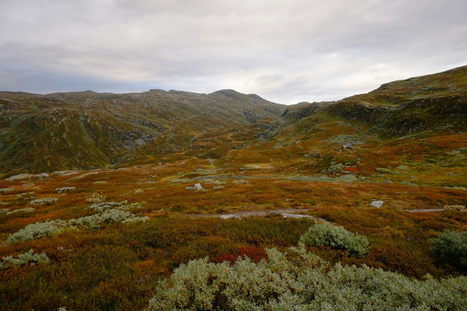
The Hardangervidda is Northern Europe’s largest mountain plateau - 8000 km² of treeless rolling country between sea level and 1700 metres. The classic west-to-east traverse, Finse to Haukelifjell, is a 6-7 day walk between DNT cabins. It is the rite of passage for Norwegian multi-day hikers and the most-walked long route in Norway after the Lofoten Trail.
It is also the route most often underestimated. There are no peaks. There are no dramatic cliffs. There is just plateau, in every direction, for days. The weather decides what kind of trip you have.
Photo: Hendrik Kespohl on Unsplash.
The classic route
| Day | From | To | Distance | Cabin |
|---|---|---|---|---|
| 1 | Finse station | Krækkja | 22 km | Krækkja (DNT) |
| 2 | Krækkja | Sandhaug | 25 km | Sandhaug (DNT) |
| 3 | Sandhaug | Litlos | 18 km | Litlos (DNT) |
| 4 | Litlos | Hellevassbu | 22 km | Hellevassbu (DNT) |
| 5 | Hellevassbu | Haukelifjell | 23 km | Haukelifjell (privately run) |
| 6 | Haukelifjell to road | Røldal | 15 km | Bus to Bergen/Oslo |
110 km total, ~1200 m elevation gain spread across six days. Daily distances of 18-25 km on flat-ish terrain - sounds easy on paper. It isn’t.
What the plateau is actually like
- Bog and stone for hours at a time. Even the marked trail crosses wet ground in places - bring waterproof boots and gaiters.
- Rivers without bridges. Several day-stages cross knee-deep streams; there is one (between Krækkja and Sandhaug) that is genuinely dangerous in high snowmelt years.
- Wind from the west for most of the season, often 30-60 km/h on the plateau. There is no shelter.
- Reindeer - about 7000 of them. Norway’s largest wild herd. You may walk past 200 in a single day in late summer.
- No mobile signal between cabins. The plateau is wide enough that satellite is patchy too. Bring a paper map.
When to go
Open season is mid-July to early September. The high passes hold snow until early July most years; by mid-September the cabins start closing for winter and weather becomes unreliable.
July: longest days, peak snowmelt, peak mosquito. August: best weather window, all cabins open, drier ground. September: golden colours, reindeer rut, 12-hour days, much colder.
Cabins and food
All five cabins on the route are DNT or DNT-affiliated. You’ll want:
- A DNT membership and key (see our DNT cabin guide)
- A sleeping bag liner (mandatory at all DNT cabins)
- Cash for a few cabins where the card terminal is unreliable
Self-service cabins along the route are well-stocked - pasta, dried meat, cheese, hardtack. You can walk the full traverse without carrying any food beyond lunch and emergency calories.
What to bring
- Waterproof boots with ankle support
- Gaiters - non-negotiable, the bog is unforgiving
- Trekking poles - for river crossings and tired knees
- Sleeping bag liner (DNT cabin requirement)
- Headlamp - most cabins have lights, the route doesn’t
- Maps - Hardangervidda Vest and Hardangervidda Aust, both at 1:50000
- Compass + know how to use it
- Rain shell - see our rain shells guide
- Insulated jacket for the evenings - it can hit 0°C even in July at 1500 m
How dangerous is it?
The plateau itself is not technical. The danger is the combination of weather, distance, and wide, undifferentiated terrain. Hikers have died on Hardangervidda - almost always from hypothermia in summer storms, almost always after pushing on instead of turning back to a cabin.
The rule that locals teach: if the weather closes in, sit it out at the nearest cabin, even if your itinerary says move on. The plateau is cabin-rich for this exact reason.
Common questions
Can I do it in fewer days?
Yes - fit walkers complete it in 5 days, ultra-runners in 2. But the daily distances become punishing and you lose the slow rhythm that makes the traverse worth doing.
What about the other directions?
East-to-west (Haukelifjell → Finse) works equally well and ends with a train journey through the Bergen Railway, which is a beautiful conclusion. North-south traverses are also possible but less well-marked.
Is reindeer dangerous?
No. Norwegian wild reindeer are skittish and will move long before you get close. Do not walk straight at them; circle around at a respectful distance.
Keep reading
- DNT cabin system - how the hut network works
- The best time to hike in Norway - when the plateau is safe
- Allemannsretten - wild-camping rules in national parks
- Hiking in Norway: the complete guide - the hub