Hardangervidda, Norway
Trolltunga Norway - Hiking the Troll's Tongue
Trolltunga Norway hiking guide: 28 km return near Odda, 800 m climb, 11 hours. Trail conditions, access options, and why most visitors underestimate the difficulty.
Published May 5, 2026 · Last updated May 5, 2026 · researched
Map data: © OpenStreetMap contributors, tiles by OpenTopoMap (CC-BY-SA). Approximate location — verify the exact route on the official trail page before hiking.
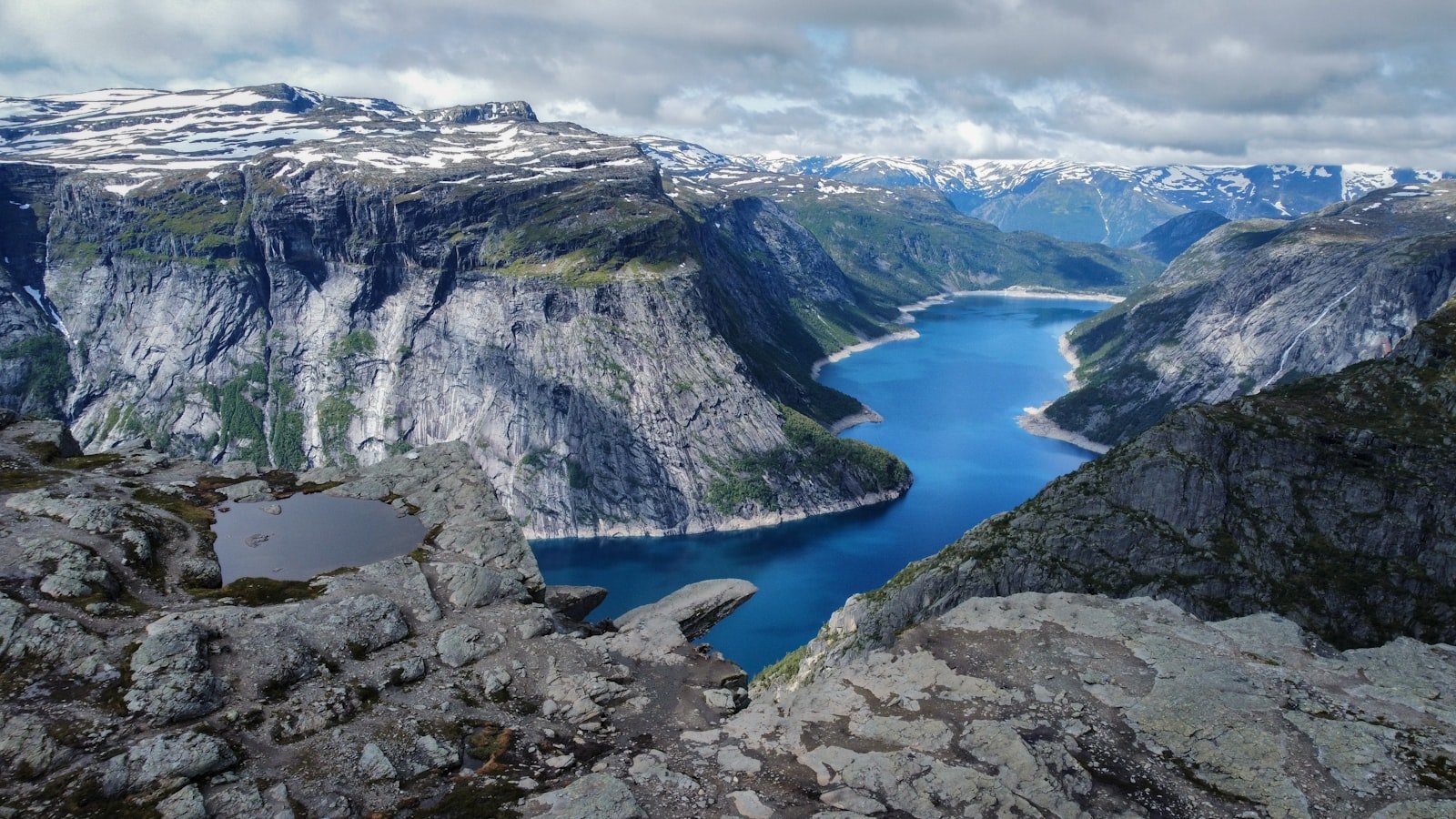
Trolltunga is a thin, horizontal slab of rock 700 metres above the Ringedalsvatnet lake - and the 28-kilometre walk to reach it. The cliff itself takes ten seconds to photograph. Getting there and back takes ten to twelve hours. This is the gap most first-time visitors miss when they book the trip.
The trail is well-marked and physically possible for any healthy walker, but it is not “an easy day out.” The Norwegian Trekking Association has classified it as demanding since 2018, and a registered guide is mandatory outside the official summer season.
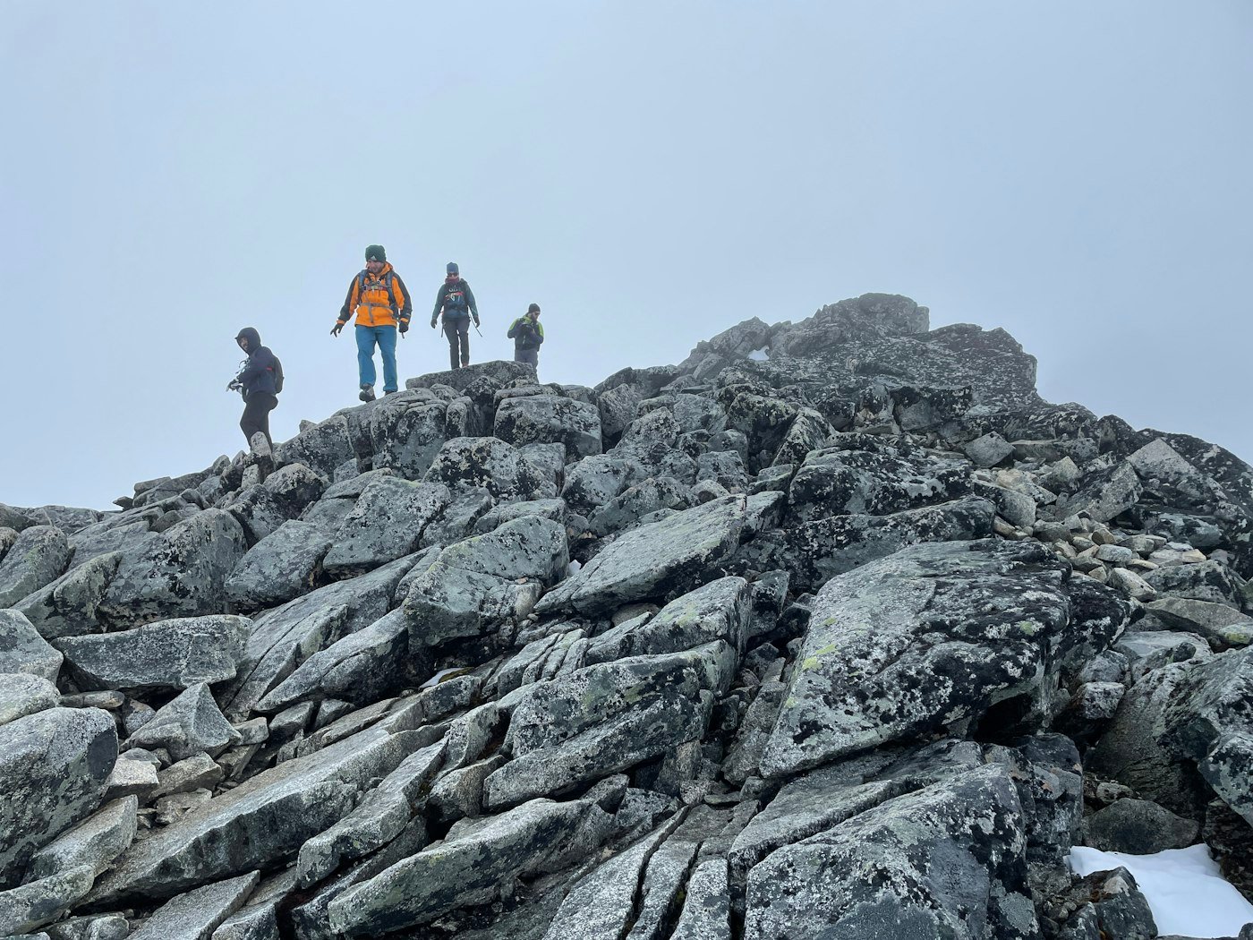
Photo: Rachel Ellis on Unsplash.
When the trail is open
| Period | Status |
|---|---|
| Mid-June to mid-September | Open without guide; bus shuttle running |
| Mid-September to mid-October | Guide-only - trail icy at altitude |
| Mid-October to mid-June | Winter route, full mountaineering equipment + registered guide |
The official “open without guide” date is set each year after a snow assessment. Check trolltunga.com before booking flights.
The route
Three start points exist. They differ in distance, elevation, and price.
| Start | Round trip | Elevation gain | Time |
|---|---|---|---|
| P2 Skjeggedal | 28 km | 800 m | 10-12 h |
| P3 Mågelitopp (shuttle bus) | 20 km | 320 m | 7-9 h |
| P3 Mågelitopp (private car, limited spots) | 20 km | 320 m | 7-9 h |
The shuttle from P2 to P3 saves the steepest 4 km of climbing at the start and is the only way most visitors do the walk in a single day. Book the shuttle in advance during peak season.
The trail itself is rolling - three serious climbs and three rolling plateaus, each one further from help than the last.
What the day actually looks like
- Start before 7 am. The trail is busiest from 10 am onwards and you do not want to be queuing for the cliff selfie.
- Pack 2 litres of water minimum - there’s a stream around km 6 but it dries up in dry summers.
- The first hour is the hardest climb of the day. Get past it and the rest is rolling.
- Eat at km 8 and km 18. Your legs forgive you for stopping; they do not forgive you for skipping food.
- The cliff is at km 14. Allow 30-45 minutes here if you want a photo without other people in it. Stand back from the edge - there is no railing.
- Turn around by 2 pm latest. People who summit at 4 pm and start back are still walking by torch when the sun drops.
Camping along the trail
There are two designated wild-camp areas: at Endanuten and on the Trolltunga plateau. Both are exposed and very busy in peak season. Most pre-arranged “Trolltunga sunset” tours camp at one of these.
If you camp on Trolltunga itself, you must:
- Use one of the marked tent areas (it’s a national park boundary)
- Camp out of sight of the cliff (yes, the photographers respect this)
- Pack out all waste, including food scraps
Allemannsretten does not override national park rules where they are stricter.
Common questions
Can I do it in a day?
Yes - most people do. But “in a day” means 10-12 hours of walking with no real rest, in mountain weather, often in light rain. If you are not used to that effort, plan two days with a campsite or a stay at the Trolltunga Active Lodge.
Is there a fee?
The shuttle from P2 to P3 has a fee (~250 NOK). The trail itself is free. Parking at P2 is paid (~250 NOK). Cards only.
Can I see Trolltunga without doing the hike?
Helicopter and boat tours offer aerial views from the lake. Both are expensive and many visitors find them less satisfying than the photo from the cliff itself.
How crowded is it?
In July, expect 1500+ hikers per day on the trail and a 30-60 minute queue for the cliff photo. Mid-September is dramatically quieter - some days fewer than 100 hikers - but cold and short on daylight.
Is it dangerous?
The trail itself is well-marked and not technical. The danger is distance + weather. People who turn back at km 8 because of fog are making the right call; people who push on into deteriorating weather are why search-and-rescue exists. Carry a printed map (Hardangervidda Sør) and a phone charger.
Sources: Visit Norway, Trolltunga.com, and the Hardangervidda national park trail authority.
Keep reading
- The best time to hike in Norway - when Trolltunga is genuinely open
- Allemannsretten - wild-camping rules along the trail
- Preikestolen - a much shorter cliff hike for the same coast
- Hiking in Norway: the complete guide - the hub